

Table of Contents
Surveying is a very important part of civil engineering, which is vital to carry out before the commencement of the construction. We will discuss the 36 best surveying tools list in this article.
35+ Best Surveying Tools List
| Name | Image | Use |
| 1. Theodolite |  | Used to measure horizontal and vertical angles |
| 2. Measuring Tape |  | Used to measure distance or size. |
| 3. Total Station |  | It is used to determine point coordinates and can also perform leveling and theodolite tasks. |
| 4. GPS | Used for determining a position (location). | |
| 5. Chains |  | Used to directly measure the linear distance between two points above the earth’s surface. |
| 6. Arrows |  | Used to mark the end of the chain length |
| 7. Pegs |  | Used to mark out residential boundaries and indicate points and positions of a site. |
| 8. Compass |  | Used to run a traverse line. |
| 9. Prisms |  | Used to reduce the scatter of the beam as it is reflected back to the total, allowing for both more accurate measurement and a longer range than the measurement can be made. |
| 10. Tripod |  | Used to support surveying instruments, such as theodolites, total stations, levels, or transits. |
| 11. Transit Levels |  | Used to determine the relative position of lines and objects as well. |
| 12. Plumb Bob | 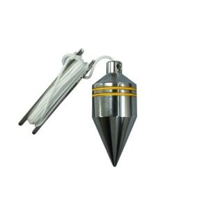 | Used to establish the nadir concerning gravity at a specific point. |
| 13. Staff |  | Used to determine the difference in height between points. |
| 14. Plane Table |  | Used to provide a solid and level surface to make field drawings, charts, and maps. |
| 15. Spirit level |  | Used to check whether an instrument is in a horizontal position or not. |
| 16. Dumpy level |  | Used to determine relative height and distance among different locations of surveying land. |
| 17. Ranging and Offset rods |  | Used for measuring small offsets from the survey line when the work is ordinary. |
| 18. Magnetic Locators |  | Used to locate static objects at varying depths, from small corner pins to large tanks, drums, and septic tanks. |
| 19. Cross Staff |  | Used to set out the perpendicular directions for offsets |
| 20. Alidade |  | Used for sighting the point in plane table surveying. |
| 21. Plumbing Fork |  | Used to center the table at a specific survey location. |
| 22. Drawing Paper |  | Used to draw a figure of stations plotted. |
| 23. Tilting level |  | Used to determine the distance between the point where the line of collimation (line-of-sight) of the level intersects the staff and the next lower staff graduation. |
| 24. Prism Square |  | Used for setting out straight lines and offset lines at 90 degrees. |
| 25. Reversible Level |  | Used to establish checkpoints in the same horizontal plane. |
| 26. Safety Gear ( Hat, ear & eye protection, etc ) |  | Used to protect the body from accidents. |
| 27. Electronic Distance Measurement (EDM) |  | Used to measure distances of up to 100 kilometers. |
| 28. GIS |  | Used to collect and analyze geographic data. |
| 29. Data Collector |  | Used to collect and store data. |
| 30. White Cement |  | Used for marking on the ground temporarily. |
| 31. Thread |  | Used to create a level line of sight that is parallel to the ruler. |
| 32. Line Ranger |  | Used for locating an intermediate point in a straight line between two endpoints of the survey line. |
| 33. Planimeter | 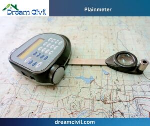 | Used to determine the area of an arbitrary two-dimensional shape (( Wikipedia: Planimeter Uses )). |
| 34. Surveying Bipods | 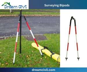 | Used to support and keep instruments stable, especially on uneven ground. |
| 35. Distance Measuring Wheel | 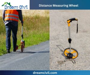 | Used to measure distance. |
| 36. Ground Penetrating Radar | 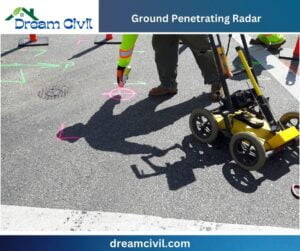 | Used in surveying subsurface materials. |
| Read Also: Topographic Surveying |
| Verified Article By Er. Madhu Krishna Poudel |