

Table of Contents
Drone surveying may be defined as an aerial survey performed utilizing drones and unique cameras to prepare aerial data having downward-facing sensors. It is majorly utilized by surveyors and engineers in the field of construction for terrain assessments and mapping.
Drone surveying can be done 90% quicker than we used to do normal surveying methods. It is used in making highly exact maps and survey points. The firms utilize drone mapping to recognize job-site errors, track work progress, predict schedule delays, etc.
1. Features of Drone Mapping and Surveying
During a drone survey, the ground is photographed many times from various angles, and each clicked image is tagged with some coordinates.
The collected data are processed utilizing drone mapping software to make construction assets like 3D models, 2D maps, and digital elevation models, from which highly precise measurements and volumetric computation are performed. The drone collects highly accurate data fastly, without the requirement for surveying staff to walk over dangerous terrain or height to gather the data.
The two common types of drone mapping methods are as follows:
a. Photogrammetry
b. LiDAR
Photogrammetry is done by clicking the high-resolution images that are later processed and collected utilizing sophisticated software to create again a survey area in the form of measurable 2D maps or 3D models. LiDAR sends pulses of light to the earth’s surface to notice small objects during the process of drone mapping.
The drones in drone mapping are made of Red Green Blue Visual Imaging (RGB) for photogrammetry, thermal, LiDAR, or multispectral sensors to gather aerial data. The various maps or deliverables gathered from drone surveying are orthomosaic maps, Digital Surface Model (DSM), Digital Terrain Model (DTM), and contour line maps.
2. Uses of Drone Surveying
The uses of drone surveying are as follows:
a. Land management and development
b. Precise measurements
c. Stockpile volumetric measurements
d. Slope monitoring
e. Urban planning
3. GCPs, PPK, and RTK in Drone Surveying
For very accurate drone surveying, it is essential to accurately point the position of a drone in flight. This can be performed either by utilizing Ground Control Points (GSPs), Real-Time Kinematic Survey (RTK), or Post Processing Kinematic (PPK) survey. GCPs are known points available in the ground whose coordinates are known. GCPs allow the drone to give precise data about its location and the distance it moved between the two locations.
As putting GCPs on the ground is time-consuming and needs labor, vehicles, equipment, and lots of paperwork, techniques like PPK and RTK have been introduced. RTK is a GPS correction technology in which the places data of the drone is given real-time corrections during the drone surveying and image clicking process.
PPK surveying is a GPS correction technology that rectifies the location data of the drone only after the finishing survey data is gathered and kept. It is done post the site work.
Contour Lines

3D Textured Mesh

Digital Surface Models

Digital Terrain Model

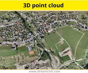
3D Point Cloud

4. Advantages of Drone Surveying
The advantages of drone Surveying are as follows:
a. Reduce field time and survey costs
b. Provide accurate and exhaustive data
c. Map otherwise inaccessible areas
5. Advantages of Drone Surveying
The disadvantages of drone surveying are as follows:
a. Multi-rotors have a limited flying time (usually 15-30 minutes).
b. They only have small payload capabilities.
c. Ground features are hard to recognize or clarify without symbols and are sometimes hidden by other ground details such as buildings in wooden areas. However, the drone mapping technique isn’t perfect.
| Read Also: Low E Glass |