

Table of Contents
1. Overview
The textural soil classification system was developed by the U.S Bureau of Soils. This system is also commonly referred to as the triangular classification of soil.
The triangular chart consists of different groups of soil indicating different percentages of sand, silt, and clay-sized particles.
In this classification, first of all, the soil sample is sieved to determine the percentage of sand, silt, and clay-sized particles. Utilizing the obtained relative percentage, the triangular chart is filled.
The textural classification of soils is highly suitable for the classification of coarse-grained soils.
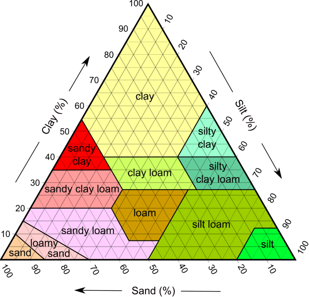
Figure: Textural System of Soil Classification
Three sides of above equilateral triangle represents the percentage of clay, silt and sand. Where size of:
Sand = 0.05 – 2 mm
Silt = 0.005 – 0.05mm
Clay = size < 0.005mm
2. Zones in Textural Soil Classification System
There are 12 zones in the triangle and each represents a different type of soil. 10 zones are:
a. Clay
b. Silty Clay
c. Sandy Clay
d. Clay Loam
e. Silty Clay Loam
f. Sandy Clay Loam
g. Loam
h. Silty Loam
i. Sandy Loam
j. Silt
k. Loamy Sand
l. Sand
3. Conclusion: Textural Soil Classification System
This method of classification doesn’t reveal any properties of the soil other than grain-size distribution. Hence it is suitable for the grain size distribution of coarse-grained soil only.
| Read Also: USCS Soil Classification System |
| Read Also: MIT Soil Classification System |